Day 13- Black Canyon of the Gunnison

Day 13 Black Canyon of the Gunnison-
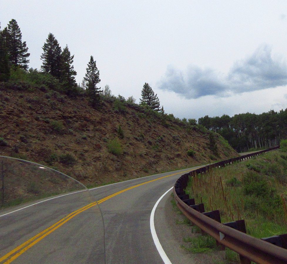
We stayed at the Antler Best Western in Glenwood Springs. Pic taken when leaving out this morning.

It is 53 degrees this morning, great riding weather when you have the right gear. This city is at around 5600 ft. elevation. Following Scott and Karin as we embark on another great day of riding.

Within the first 20 miles, Scott pulled over. They have an emergency back home, so they are hightailing it back, and they've given us...

...the map for where they were going to lead us today to and thru the Black Canyon.

After they took off, Mary and I talked about if we wanted to do the Black Canyon, or maybe some other route. (we were having a hard time picturing that the Black Canyon would be as spectacular as some of the other possibilities in Colorado).
In the end, we realized Scott has always led us on epic rides, and that we should trust him on this. So we punched in his written instructions into the GPS, and off we went!
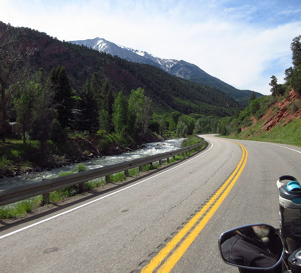
From the get go, this ride has everything. Good winding roads, a stream along side the road and fantastic views!
Along the way we saw this little one lane wooden bridge over the stream, so we rode across...

...took some photo's, turned around and rode back across....

...and got back on the road to the Black Canyon...

...What a perfect day of riding this is turning into, between the views, the cool weather, the relaxing curving road. Wow!

The views along the way toward the Black Canyon are stunning.

Cloud Pic...Some of Mary's favorite type photos.

Curve after curve of...

...amazing views!

The road is smooth, the curves just keep coming, the TG is running great, and Mary and I are just taking it all in...

...this road is so nice, not straight, but not twisty. Winding around, a very relaxed ride, with different views around every curve.

That water is moving VERY fast, right next to the road. We wondered if it every got so full that it overflowed onto the road.

I've gotten feedback, many of the folks in Colorado know...

...how good they have it. The riding here is just crazy good!

We're starting a few miles of steep climbing up to the summit of Mc Clure Pass.

Looking back as we climb to the summit...

...another look back. Sometimes I see stuff in the mirrors and let Mary know...other times she is just checking it out herself. A lot of times the views are so different, makes you want to ride the road the other way once you're done with the first way. lol

Still climbing. This is one of the few other vehicles we saw this morning. Great cloud pic.

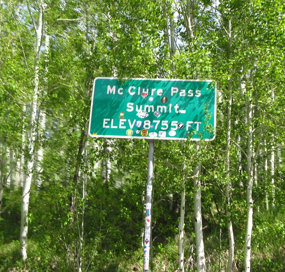
Crossed the summit at 60 mph...Mary snapped this photo. At 8755 feet, it's not high relative to many others we've been riding, but it was a nice ride up...now for the ride down.
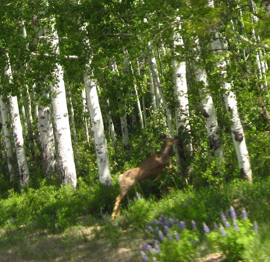
Almost right away this deer ran straight across the road in front of us. We were doing 60 mph, the deer was going ??? mph. Mary got a great photo of her, both front legs off the ground, rear legs stretched out.
Clouds are great this morning. Road is fun too.

Still heading down. Winding relaxing road, constantly changing scenery.

Great cloud pic, and that looks like a "fun ahead" sign up there!

We've been following along this lake for quite a while...

...decided to pull over for a little break and a closer look.

Back rolling. It is blowing my mind how many great roads and sights there are here in Colorado!

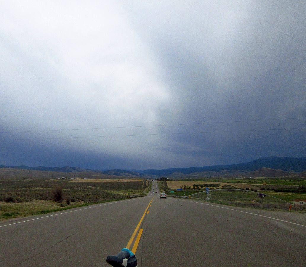
We're still on our way toward the Black Canyon of the Gunnison. After turning left, we are headed toward a pretty big storm.

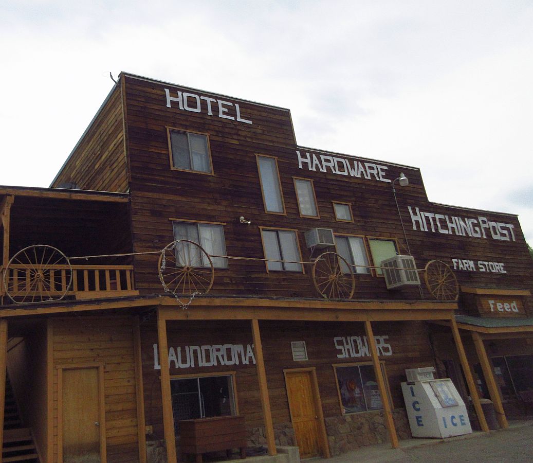
Rolling thru the town of Crawford, Mary got this pic of the biggest store in town.
I've been doing a good job so far of not letting us get near empty. 80 miles til more gas, AND it looks like rain. We have enough gas for over 140 miles.

This turn off to the Black Canyon was miles of gravel, and headed straight into the rain...we opted to stay on the asphalt.

But we are still just barely skirting the rain!

Starting to get colder and more wind as we are on the edge of the rain. Stopped to put on our rain jackets.

Rain has been thru here earlier...road's a bit wet. We're just getting sprinkles here and there. Not really enough to need the rain jackets, but it's pretty cool also, so they're doing a good job at keeping the wind out.

Looking back at where we came from...it's amazing how we've been missing the rain for the last couple of hours.

Our first glimpse of part of the Black Canyon, off in the distance.

Now that we are running along side the Black Canyon...I am torn between how fun the road is and the views!

The road is a blast to ride...

...I really enjoy twisty roads, and when there are elevation changes in the curves, all the better!
We're still dancing with the rain, barely staying away from it.

Downhill into a sharp curve....

...and sharply uphill into some nicely cambered curves!

Starting to see more of the canyon, rolling down the road.
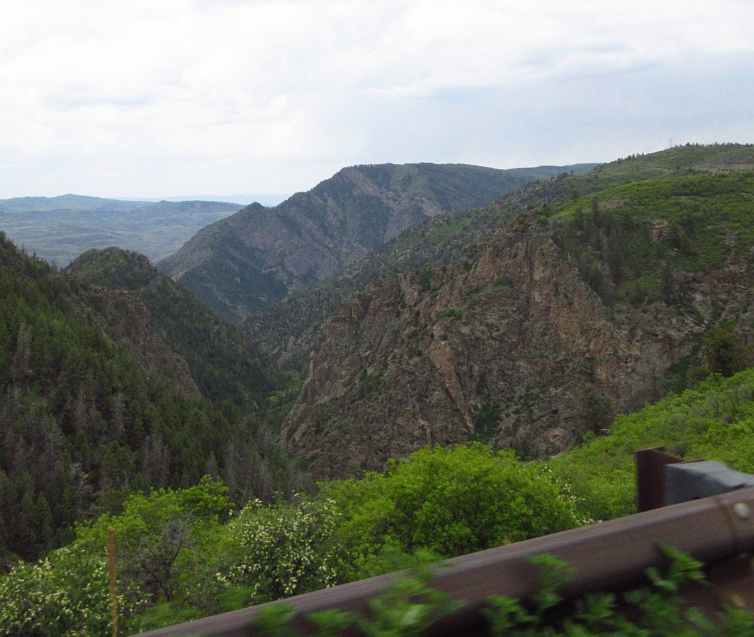
That's quite a view as we're rolling...

...and another one. These photo's are not conveying how large everything looks in person today. This place is HUGE!

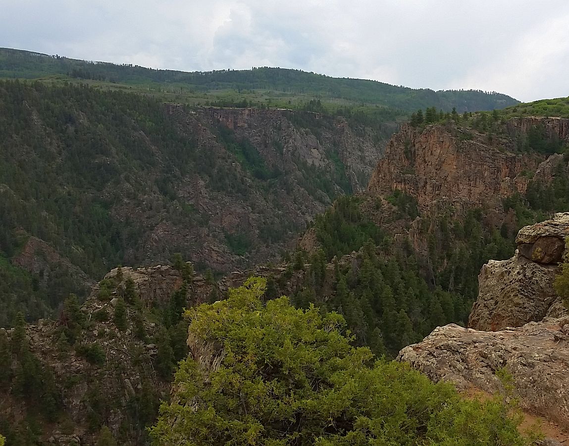
This photo shows where we are riding just barely inside the canyon...see canyon details below.

Just looked up some specs on the canyon-
The Black Canyon is incredibly deep and sheer, with plunging cliffs, soaring buttresses and a thundering river. The following lists will help you understand the physical size of the canyon in comparison to other canyons and man-made structures.
The Black Canyon is incredibly deep and sheer, with plunging cliffs, soaring buttresses and a thundering river. The following lists will help you understand the physical size of the canyon in comparison to other canyons and man-made structures.
Greatest Depth:
Warner Point 2,722 feet (829 m)
Chasm View 1,820 feet (555 m)
Gunnison Point 1,840 feet (561 m)
Narrowest Width:At the rim (Chasm View) 1,100 feet (335 m)
At the river (The Narrows) 40 feet (12 m)
Total Length of Black Canyon: 48 miles (77 km)
Length in National Park 14 miles (22.5 km)
We pulled off the road to get some pics...

...this place is massive!

Mary did not even take her helmet off....she just jumped off the TG and started running around taking pics. lol

She really likes it here.

Walking down to the edge to get some pics with my phone camera.

It really is quite a long, and steep, ways down!

Wow!
We really did not do a good job of capturing how big and magnificent this place is...but we tried.

Back rolling now, Mary gets this pic off to the side...

...Mary in the Mirror, taking a pic in front of us, right before a sharp curve to the right.

We're back rolling now, enjoying some off camber, curving road as we...

...get near the end of the Black Canyon.

We're still seeing some pretty good views of it...

as we're riding along side on a really fun road.

Another really great shot as we're riding...

...and then "The End" of the Canyon.

We're now on the 50. We traveled this same road just 3 days ago. It takes us thru Gunnison, over Monarch Crest, over Wilkerson Summit, thru Woodland Park, and into Colorado Springs.

Some fellow riders....and some rain ahead...

...all day we've been missing the rain, just a little drizzle here and there. Up ahead looks pretty nasty, but there is a gap.
Starting up the 7 mile climb to the summit of Monarch Pass. It's cloudy today, and I'm not going to post a lot of pics...back on Day 10 we rode it and it was beautiful blue skies...posted a bunch of photo's from that day.

Climbing up to Monarch Crest is two lanes the whole way. We already rode it a few days ago, so I hauled ass up it, totally enjoying how strong the TG is pulling and how well it is handling.

Fortunately everyone stayed in the right lane, and I was not slowed down by cages one time.

We rode right by the summit and...

...kept ripping it thru the curves down the other side...

....it was a lot of fun, got my adrenaline going a bit....then after about a mile on the downhill we ran into traffic (single lane) and took it easy the rest of the way down.

Starting up Wilkerson Pass

Getting close to Woodland Park. (I'm skipping big parts of this ride...you can see more photo's of this part of the ride on Day 10)

In the little curvy, scenic road, right....

...before Colorado Springs.

That's Colorado Springs, straight ahead.

Day 13 Conclusion-
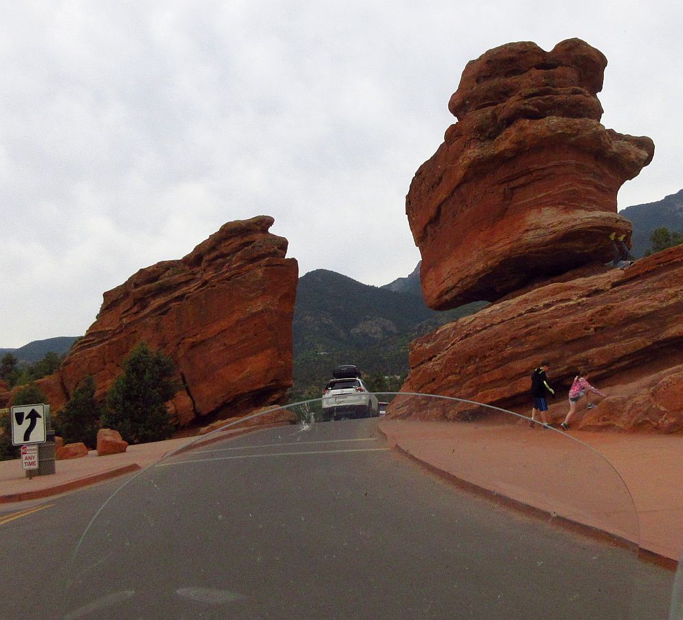
Right on the edge of Colorado Springs is a Park called Garden of the Gods...

...a look back at what we just rode thru...

...the views are astounding, the speed limit is slow, and that is good...

...no one is in a hurry. There is so much to see.

There is about 5 miles of road, all of it with view after view.

We did not stop, but we spent about an hour on those 5 miles of road!

Just amazing, if we were not near the end of an 11 hour day...

...we would park the bike and hiked around a bit.

Fantastic Place, we're gonna have to come back here and spend some time.
Off to Scott & Karin's place. Nice evening visiting. Great people!
Tomorrow we are off to Wyoming, with a stop on the way to visit Brandon at Devils Head Choppers.